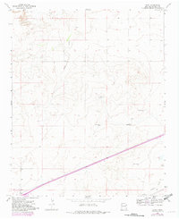
1968 Map of Bard
USGS Topo · Published 1982About this map
Bard occupies the southwestern corner of this landscape in eastern Quay County, where the plains of New Mexico meet the edge of the Texas Panhandle. This survey reflects the region's reliance on ranching and thoroughfare travel, dominated by a network of windmills such as Salty Windmill, Tree Windmill, and Twin Windmills that sustain life across the arid terrain. The mapping of Route 66 cutting across the southern portion of the sheet highlights the era's primary cross-country transit corridor, which ran parallel to drainages like Trujillo Creek and San Jon Cr. For genealogists and local historians, the inclusion of the Endee Cem near the eastern boundary offers a specific point of interest for tracing early families who settled this high plains region. The presence of a Landing Strip near the town center further emphasizes the necessity of aerial connectivity in such a low-density rural environment.
Find a feature on this map
13 named features on this map. Tap any name to fly to it.
Don’t see what you’re looking for? This feature index may not catch every label — zoom into the map to look around manually.
Map Details
Editions of this 1968 Bard Map
2 editions found
Other maps of this area

1954 · Tucumcari
USGS Topo · 1:250,000

1958 · Tucumcari
USGS Topo · 1:250,000

1962 · Logan
USGS Topo · 1:62,500

1968 · Porter
USGS Topo · 1:24,000

1968 · Rock Camp
USGS Topo · 1:24,000

1968 · Blue Hole
USGS Topo · 1:24,000

1968 · Riley Camp
USGS Topo · 1:24,000

1968 · San Jon
USGS Topo · 1:24,000

1968 · Bard
USGS Topo · 1:24,000

1968 · Glenrio
USGS Topo · 1:24,000