
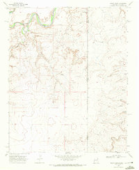
1966 Map of Trujillo Camp
USGS Topo · Published 1969About this map
The Canadian River carves a deep, winding path through the high plains of Oldham County, defining the drainage patterns of this arid landscape. During the mid-1960s, the area remained sparsely settled, characterized by large ranching tracts and scattered water sources. The map identifies Trujillo Camp and the Chavez City Ruins, which mark significant points of human activity along the northern and eastern reaches of the river.
Find a feature on this map
10 named features on this map. Tap any name to fly to it.
Don’t see what you’re looking for? This feature index may not catch every label — zoom into the map to look around manually.
Map Details
Editions of this 1966 Trujillo Camp Map
This is the sole edition of this map. No revisions or reprints were ever made.
Other maps of this area

1954 · Tucumcari
USGS Topo · 1:250,000

1958 · Tucumcari
USGS Topo · 1:250,000

1966 · Signal Spring
USGS Topo · 1:24,000

1966 · Signal Spring SE
USGS Topo · 1:24,000

1966 · Vat Camp
USGS Topo · 1:24,000

1968 · Sanchez Springs
USGS Topo · 1:24,000
1968 · Martin Draw
USGS Topo · 1:24,000

1971 · Romero SE
USGS Topo · 1:24,000

1971 · Nara Visa
USGS Topo · 1:24,000

1971 · Knoblaw
USGS Topo · 1:24,000