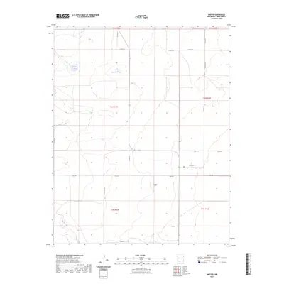
2023 Map of Amistad
USGS Topo · Published 2023About this map
The high plains of Union County near Amistad are defined by a network of rural roads and isolated water bodies in this contemporary survey. The settlement itself is centered around a Po and is connected to the surrounding ranchland via Nile E Rd and Ricketson Rd. To the south, the Amistad Cem serves as a significant genealogical marker for local families. The landscape is dotted with alkaline and seasonal basins, most notably Salt Lake and Maestas Lake, which sit amidst the township and range divisions of the northeast New Mexico desert. In the southwestern quadrant, the drainage of Monia Creek cuts through the terrain, while roads like Stone Haven Rd and Cinch Rd trace the paths between expansive properties and historic land tracts.
Find a feature on this map
27 named features on this map. Tap any name to fly to it.
Don’t see what you’re looking for? This feature index may not catch every label — zoom into the map to look around manually.
Map Details
Editions of this 2023 Amistad Map
This is the sole edition of this map. No revisions or reprints were ever made.
Other maps of this area

1954 · Tucumcari
USGS Topo · 1:250,000

1954 · Dalhart
USGS Topo · 1:250,000

1958 · Tucumcari
USGS Topo · 1:250,000

1958 · Dalhart
USGS Topo · 1:250,000

1962 · Dalhart
USGS Topo · 1:250,000

1966 · Skull Mesa
USGS Topo · 1:24,000

1966 · Ione
USGS Topo · 1:24,000

1966 · Hayden
USGS Topo · 1:24,000

1970 · Stead
USGS Topo · 1:24,000

1970 · Sedan SE
USGS Topo · 1:24,000