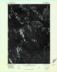
1975 Map of Amity NE
USGS Topo · Published 1980About this map
North Amity occupies a central position along the north-south transport corridor of this Maine borderland, where the forest canopy is interrupted by the geometric patterns of agricultural clearings. As an orthophotoquad, the document reveals the literal texture of the landscape as it appeared in the mid-1970s, showcasing the dense woodland typical of the Aroostook region. The international boundary between the United States and Canada is a prominent feature, tracing the eastern edge of the quadrangle along Maine and New Brunswick. To the south, the terrain rises toward Spring Hill, while the meandering course of Monument Stream defines the lower drainage patterns. The visual data provides a clear distinction between the managed farm plots near the settlement and the expansive timberlands that dominate the rest of the territory.
Find a feature on this map
5 named features on this map. Tap any name to fly to it.
Don’t see what you’re looking for? This feature index may not catch every label — zoom into the map to look around manually.
Map Details
Editions of this 1975 Amity NE Map
This is the sole edition of this map. No revisions or reprints were ever made.
Other maps of this area

1938 · Houlton
USGS Topo · 1:62,500

1940 · Amity
USGS Topo · 1:62,500

1941 · Amity
USGS Topo · 1:62,500

1943 · Amity
USGS Topo · 1:62,500

1951 · Houlton
USGS Topo · 1:62,500

1957 · Fredericton
USGS Topo · 1:250,000
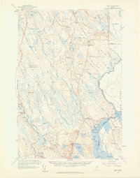
1958 · Amity
USGS Topo · 1:62,500

1959 · Woodstock
USGS Topo · 1:250,000

1963 · Woodstock
USGS Topo · 1:250,000

1963 · Fredericton
USGS Topo · 1:250,000