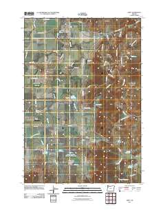
2011 Map of Amity
USGS Topo · Published 2011About this map
Amity Hills and the rising ground of Eola Crest dominate the eastern landscape of this Willamette Valley region. The town of Amity serves as the primary hub, with local landmarks such as the Amity Post Office and Amity Cemetery serving as vital touchpoints for genealogical research. Further south, the map details smaller rural communities including McCoy, Bethel, and Zena, each tied to the land through a series of local burial grounds like Bethel Cemetery and Zena Cemetery.
Find a feature on this map
71 named features on this map. Tap any name to fly to it.
Don’t see what you’re looking for? This feature index may not catch every label — zoom into the map to look around manually.
Map Details
Editions of this 2011 Amity Map
This is the sole edition of this map. No revisions or reprints were ever made.
Other maps of this area

1915 · Rickreall
USGS Topo · 1:31,680

1915 · Eola
USGS Topo · 1:31,680

1917 · Salem
USGS Topo · 1:62,500

1924 · Mc Minnville
USGS Topo · 1:48,000

1926 · Mc Minnville
USGS Topo · 1:62,500

1940 · McMinnville
USGS Topo · 1:62,500

1940 · Salem
USGS Topo · 1:62,500

1942 · Sheridan
USGS Topo · 1:62,500

1942 · Dallas
USGS Topo · 1:62,500

1948 · Vancouver
USGS Topo · 1:250,000