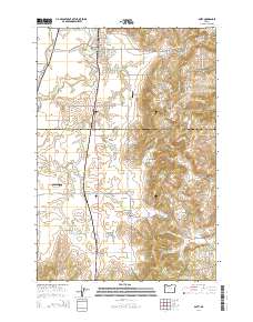
2014 Map of Amity
USGS Topo · Published 2014About this map
The town of Amity serves as the focal point of this region where the Yamhill Co and Polk Co lines meet. The landscape is defined by the transition from the flat agricultural plains of Salt Creek and Ash Swale to the rising elevations of the Amity Hills and Eola Hills. This area is heavily dotted with small-scale water management features, including the Anderson Reservoir, Phil Olson Reservoir, and Kraitz Reservoir, reflecting the intensive land use and drainage patterns of Oregon's Willamette Valley. Traces of early settlement are preserved in several burial grounds such as Amity Cem, Bethel Cem, and Zena Cem. Small communities like Bethel and Plum Valley are situated south of the main town, connected by a network of local roads including Or 99w and the Bellevue-Hopewell Hwy. Small private airfields, such as Red's Field Airport and Vineyard Airport, highlight the local aviation infrastructure in this rural corridor.
Find a feature on this map
90 named features on this map. Tap any name to fly to it.
Don’t see what you’re looking for? This feature index may not catch every label — zoom into the map to look around manually.
Map Details
Editions of this 2014 Amity Map
This is the sole edition of this map. No revisions or reprints were ever made.
Other maps of this area

1915 · Rickreall
USGS Topo · 1:31,680

1915 · Eola
USGS Topo · 1:31,680

1917 · Salem
USGS Topo · 1:62,500

1924 · Mc Minnville
USGS Topo · 1:48,000

1926 · Mc Minnville
USGS Topo · 1:62,500

1940 · McMinnville
USGS Topo · 1:62,500

1940 · Salem
USGS Topo · 1:62,500

1942 · Sheridan
USGS Topo · 1:62,500

1942 · Dallas
USGS Topo · 1:62,500

1948 · Vancouver
USGS Topo · 1:250,000