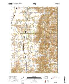
2020 Map of Amity
USGS Topo · Published 2020About this map
Amity Hills and the Eola Hills anchor this Willamette Valley landscape, where the town of Amity serves as the primary northern settlement. This area is defined by a complex network of agricultural water management, evidenced by numerous named irrigation and storage sites like Phil Olson Reservoir, Wilson Reservoir, and the Martin Brothers Flashboard Reservoir. The terrain transitions from the low-lying Ash Swale to the higher elevations of Eola Crest, a geography that has supported both traditional farming and the more recent development of the Vineyard Airport.
Find a feature on this map
89 named features on this map. Tap any name to fly to it.
Don’t see what you’re looking for? This feature index may not catch every label — zoom into the map to look around manually.
Map Details
Editions of this 2020 Amity Map
This is the sole edition of this map. No revisions or reprints were ever made.
Other maps of this area

1915 · Rickreall
USGS Topo · 1:31,680

1915 · Eola
USGS Topo · 1:31,680

1917 · Salem
USGS Topo · 1:62,500

1924 · Mc Minnville
USGS Topo · 1:48,000

1926 · Mc Minnville
USGS Topo · 1:62,500

1940 · McMinnville
USGS Topo · 1:62,500

1940 · Salem
USGS Topo · 1:62,500

1942 · Sheridan
USGS Topo · 1:62,500

1942 · Dallas
USGS Topo · 1:62,500

1948 · Vancouver
USGS Topo · 1:250,000