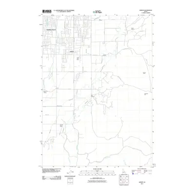
2011 Map of Ammon
USGS Topo · Published 2011About this map
The Ammon and Idaho Falls area is defined by a sophisticated network of water management features on the Snake River Plain, where the desert landscape is transformed by an intricate grid of irrigation infrastructure. This 2011 survey details the complex system of the Ammon Extension Canal, Highline Canal, and Meppen Canal that sustain the region's agricultural and residential expansion. While the western portion shows the densifying street grids of Ammon, the eastern terrain rises toward the more varied topography of Euchre Valley and Black Canyon. Local landmarks such as the Sandy Downs Rodeo Grounds and the Rainbow Ranch Airport reflect the mix of rural tradition and modern utility. Genealogists will find the Ammon Cemetery and Iona Cemetery clearly marked, while the southern reach of the quadrangle follows the winding path of Henry Creek into Rock Hollow.
Find a feature on this map
44 named features on this map. Tap any name to fly to it.
Don’t see what you’re looking for? This feature index may not catch every label — zoom into the map to look around manually.
Map Details
Editions of this 2011 Ammon Map
This is the sole edition of this map. No revisions or reprints were ever made.
Other maps of this area

1924 · Ammon
USGS Topo · 1:62,500

1948 · Idaho Falls North
USGS Topo · 1:24,000

1948 · Idaho Falls South
USGS Topo · 1:24,000

1948 · Ucon
USGS Topo · 1:24,000

1949 · Ucon
USGS Topo · 1:24,000

1949 · Idaho Falls North
USGS Topo · 1:24,000

1949 · Roberts
USGS Topo · 1:62,500

1950 · Idaho Falls South
USGS Topo · 1:24,000

1950 · Rigby
USGS Topo · 1:62,500

1950 · Goshen
USGS Topo · 1:24,000