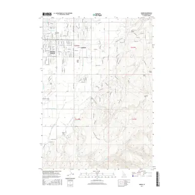
2017 Map of Ammon
USGS Topo · Published 2017About this map
Ammon and the eastern edge of Idaho Falls occupy this landscape where the flat expanse of the Snake River Plain meets the rising elevations of Galbraith Hill. The 2017 survey reveals an intricate network of irrigation infrastructure essential to the region's agricultural heritage, including the Taylor Extension Canal, Meppen Canal, and the Meppen Spillway. These waterways, alongside the Hillside Canal and Highline Canal, illustrate how water management has historically dictated the settlement patterns and land use in Bonneville County. Institutional landmarks such as the Eastern Idaho Technical College and Ammon Cem provide specific points of interest for local historians and genealogists. To the south, the Rainbow Ranch Airport and the descent into Rock Hollow mark the transition from suburban development to the varied terrain of the Snake River Valley.
Find a feature on this map
65 named features on this map. Tap any name to fly to it.
Don’t see what you’re looking for? This feature index may not catch every label — zoom into the map to look around manually.
Map Details
Editions of this 2017 Ammon Map
This is the sole edition of this map. No revisions or reprints were ever made.
Other maps of this area

1924 · Ammon
USGS Topo · 1:62,500

1948 · Idaho Falls North
USGS Topo · 1:24,000

1948 · Idaho Falls South
USGS Topo · 1:24,000

1948 · Ucon
USGS Topo · 1:24,000

1949 · Ucon
USGS Topo · 1:24,000

1949 · Idaho Falls North
USGS Topo · 1:24,000

1949 · Roberts
USGS Topo · 1:62,500

1950 · Idaho Falls South
USGS Topo · 1:24,000

1950 · Rigby
USGS Topo · 1:62,500

1950 · Goshen
USGS Topo · 1:24,000