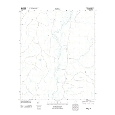
2012 Map of Amory SE
USGS Topo · Published 2012About this map
Mormon Springs serves as the central point of this Monroe County landscape, situated along the winding banks of the Buttahatchee River. The topography is defined by a dense network of watercourses, including Alsup Cr, Rye Cr, and Grub Springs Br, which drain the surrounding agricultural and timber lands. This area is notably dense with small family or community burial grounds, providing a significant resource for genealogical research. These sites, such as Jones Cem, Sartor Cem, and the uniquely named Moss and Reed Cem, are scattered across the terrain near old road alignments like Sartor Rd and Bartahatchie Rd. The presence of Cockerham Lake and numerous branches like Sams Br and Honoll Mill Cr reflects the well-watered nature of this region northeast of Aberdeen, where local life has long been tied to the river's floodplain and its many tributaries.
Find a feature on this map
51 named features on this map. Tap any name to fly to it.
Don’t see what you’re looking for? This feature index may not catch every label — zoom into the map to look around manually.
Map Details
Editions of this 2012 Amory SE Map
This is the sole edition of this map. No revisions or reprints were ever made.
Other maps of this area

1953 · West Point
USGS Topo · 1:250,000

1958 · West Point
USGS Topo · 1:250,000

1960 · Caledonia
USGS Topo · 1:62,500

1963 · West Point
USGS Topo · 1:250,000

1966 · Amory
USGS Topo · 1:24,000

1966 · Amory SW
USGS Topo · 1:24,000

1966 · Greenwood Springs
USGS Topo · 1:24,000

1966 · Amory SE
USGS Topo · 1:24,000

1967 · Sulligent
USGS Topo · 1:24,000

1967 · Sulligent SW
USGS Topo · 1:24,000