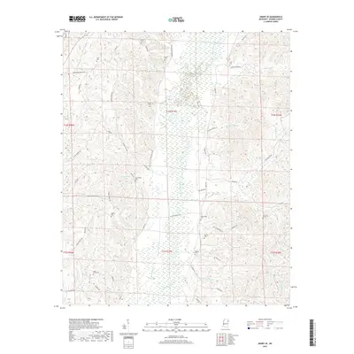
2018 Map of Amory SE
USGS Topo · Published 2018About this map
The Buttahatchee River meanders through this portion of Monroe County, defining a landscape of wetlands and complex creek systems. This 2018 survey documents a region deeply marked by its family legacies, evidenced by the high density of small burial grounds like Jones Cem, Sartor Cem, and Marchbanks Cem. The presence of Cockerham Lake and numerous named branches, such as Morman Springs Br and Rocky Bluff Br, indicates the water-rich geography that has likely influenced settlement and land use for generations. Small rural corridors like Red Hill Rd and Bartahatchie Rd provide the primary access to these tucked-away cemeteries and homesteads. Researchers focusing on North Mississippi genealogy will find value in the precise locations of family-named landmarks and the intricate network of local roads that connect the dispersed rural population.
Find a feature on this map
60 named features on this map. Tap any name to fly to it.
Don’t see what you’re looking for? This feature index may not catch every label — zoom into the map to look around manually.
Map Details
Editions of this 2018 Amory SE Map
This is the sole edition of this map. No revisions or reprints were ever made.
Other maps of this area

1953 · West Point
USGS Topo · 1:250,000

1958 · West Point
USGS Topo · 1:250,000

1960 · Caledonia
USGS Topo · 1:62,500

1963 · West Point
USGS Topo · 1:250,000

1966 · Amory
USGS Topo · 1:24,000

1966 · Amory SW
USGS Topo · 1:24,000

1966 · Greenwood Springs
USGS Topo · 1:24,000

1966 · Amory SE
USGS Topo · 1:24,000

1967 · Sulligent
USGS Topo · 1:24,000

1967 · Sulligent SW
USGS Topo · 1:24,000