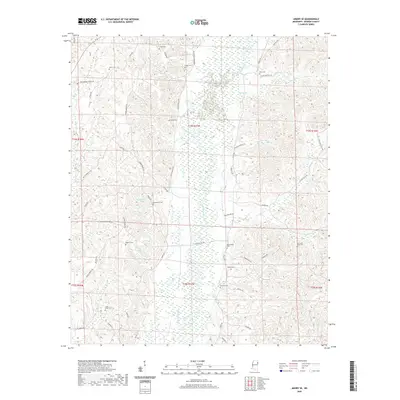
2020 Map of Amory SE
USGS Topo · Published 2020About this map
The Buttahatchee River winds through the heart of this Monroe County landscape, defining the low-lying wetlands and drainage patterns of the region. The map reveals a high concentration of small family burial grounds, providing significant value for genealogical research in this part of Mississippi. From the Sartor Cem in the north to the Moss and Reed Cem in the east, these sites are often situated near historical road networks like Greenwood Springs Rd and Bartahatchie Rd. The presence of Cockerham Lake and numerous named tributaries such as Mormon Spring Br and Alsup Cr illustrates the well-watered nature of the terrain, where rural life has long been organized around these natural watercourses and the modest elevation changes between river bottoms and upland ridges.
Find a feature on this map
59 named features on this map. Tap any name to fly to it.
Don’t see what you’re looking for? This feature index may not catch every label — zoom into the map to look around manually.
Map Details
Editions of this 2020 Amory SE Map
This is the sole edition of this map. No revisions or reprints were ever made.
Other maps of this area

1953 · West Point
USGS Topo · 1:250,000

1958 · West Point
USGS Topo · 1:250,000

1960 · Caledonia
USGS Topo · 1:62,500

1963 · West Point
USGS Topo · 1:250,000

1966 · Amory
USGS Topo · 1:24,000

1966 · Amory SW
USGS Topo · 1:24,000

1966 · Greenwood Springs
USGS Topo · 1:24,000

1966 · Amory SE
USGS Topo · 1:24,000

1967 · Sulligent
USGS Topo · 1:24,000

1967 · Sulligent SW
USGS Topo · 1:24,000