
1966 Map of Amory SE
USGS Topo · Published 1968About this map
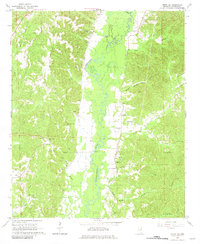
The Buttahatchie River meanders through the heart of this Monroe County landscape, defining the local geography as it flows past bottomlands and gravel-rich deposits. The map captures a rural Mississippi community in the mid-1960s, where small country churches like Buttahatchie Ch and Pleasant Grove Ch serve as local landmarks. The distribution of family burial grounds is particularly dense here, including the Marchbanks Cem, Cockerham Cem, and Sartor Cem, providing an invaluable spatial record for genealogical research. At the southern edge, the Honnell Mill site sits near Rock Bluff, reflecting the historical importance of water-powered industry and river-adjacent settlements. This era of land use is further marked by the presence of numerous Gravel Pits and early extraction efforts at several Gas Wells, showing the area's transition toward industrial resource management while maintaining its traditional crossroads character at the Community Center.
Find a feature on this map
38 named features on this map. Tap any name to fly to it.
Don’t see what you’re looking for? This feature index may not catch every label — zoom into the map to look around manually.
Map Details
Editions of this 1966 Amory SE Map
2 editions found
Other maps of this area

1953 · West Point
USGS Topo · 1:250,000

1958 · West Point
USGS Topo · 1:250,000

1960 · Caledonia
USGS Topo · 1:62,500

1963 · West Point
USGS Topo · 1:250,000

1966 · Amory
USGS Topo · 1:24,000

1966 · Amory SW
USGS Topo · 1:24,000

1966 · Greenwood Springs
USGS Topo · 1:24,000

1967 · Sulligent
USGS Topo · 1:24,000

1967 · Sulligent SW
USGS Topo · 1:24,000

1967 · Millport NW
USGS Topo · 1:24,000