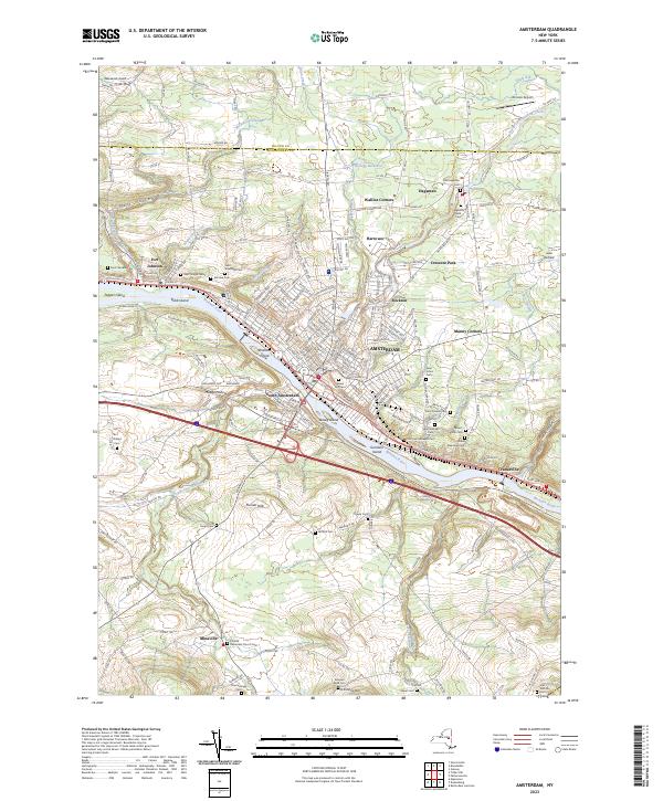
2023 Map of Amsterdam
USGS Topo · Published 2023About this map
The Mohawk River flows through the center of this landscape, separating Amsterdam and South Amsterdam while surrounding several named landforms including Bronson Island and Davey Island. To the north, the terrain is shaped by North Chuctanunda Creek and the Kellogg Reservoir, supporting smaller communities like Hagaman and Fort Johnson. This modern survey illustrates the dense concentration of religious and civic landmarks that define the region’s heritage, particularly the numerous burial grounds like Green Hill Cem and Hagaman Mills Cem. The area’s varied topography is evident in features like Hell Hollow and Mudge Hollow, while the presence of Wenskoski Field and Johnson Airport highlights the local aviation infrastructure serving this historic Montgomery County corridor.
Find a feature on this map
208 named features on this map. Tap any name to fly to it.
Don’t see what you’re looking for? This feature index may not catch every label — zoom into the map to look around manually.
Map Details
Editions of this 2023 Amsterdam Map
This is the sole edition of this map. No revisions or reprints were ever made.
Other maps of this area

1895 · Amsterdam
USGS Topo · 1:62,500

1896 · Fonda
USGS Topo · 1:62,500

1898 · Fonda
USGS Topo · 1:62,500

1899 · Broadalbin
USGS Topo · 1:62,500

1902 · Broadalbin
USGS Topo · 1:62,500

1902 · Fonda
USGS Topo · 1:62,500

1903 · Gloversville
USGS Topo · 1:62,500

1931 · Amsterdam
USGS Topo · 1:62,500

1943 · Gloversville
USGS Topo · 1:62,500
1943 · Esperance
USGS Topo · 1:24,000