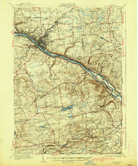
1931 Map of Amsterdam
USGS Topo · Published 1938About this map
The Mohawk River corridor anchors this industrial and agricultural landscape between the wars, defined by the parallel paths of the Erie Barge Canal and the New York Central and Hudson River railroad. The city of Amsterdam serves as a dense manufacturing hub, surrounded by outlying settlements like Rockton and South Amsterdam. North of the river, the landscape transitions into the upland farms of Charlton, while to the south, the terrain rises toward the heights of McKinney Hill and Shellstone Hill.
Find a feature on this map
91 named features on this map. Tap any name to fly to it.
Don’t see what you’re looking for? This feature index may not catch every label — zoom into the map to look around manually.
Map Details
Editions of this 1931 Amsterdam Map
3 editions found

Other maps of this area

1893 · Schenectady
USGS Topo · 1:62,500

1893 · Albany
USGS Topo · 1:62,500

1895 · Albany
USGS Topo · 1:62,500

1895 · Schenectady
USGS Topo · 1:62,500

1895 · Amsterdam
USGS Topo · 1:62,500

1896 · Fonda
USGS Topo · 1:62,500

1898 · Schenectady
USGS Topo · 1:62,500

1898 · Albany
USGS Topo · 1:62,500

1898 · Fonda
USGS Topo · 1:62,500

1898 · Schoharie
USGS Topo · 1:62,500