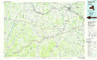
1985 Map of Amsterdam
USGS Topo · Published 1986About this map
Amsterdam and the industrialized Mohawk Valley anchor the northern reach of this 1985 planimetric study, where the Mohawk River serves as a corridor for the New York State Thruway and the Conrail railroad system. Moving south into the Schoharie Valley, the landscape shifts toward the rural and academic, centered on the State University of New York at Cobleskill and the civic landmarks of the Schoharie County Courthouse.
Find a feature on this map
341 named features on this map. Tap any name to fly to it.
Don’t see what you’re looking for? This feature index may not catch every label — zoom into the map to look around manually.
Map Details
Editions of this 1985 Amsterdam Map
2 editions found
Other maps of this area

1893 · Schenectady
USGS Topo · 1:62,500

1893 · Coxsackie
USGS Topo · 1:62,500

1893 · Durham
USGS Topo · 1:62,500

1893 · Albany
USGS Topo · 1:62,500

1894 · Coxsackie
USGS Topo · 1:62,500

1894 · Durham
USGS Topo · 1:62,500

1895 · Albany
USGS Topo · 1:62,500

1895 · Schenectady
USGS Topo · 1:62,500

1895 · Amsterdam
USGS Topo · 1:62,500

1896 · Fonda
USGS Topo · 1:62,500