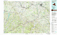
1985 Map of Amsterdam
USGS Topo · Published 1993About this map
The Mohawk River corridor anchors this region during the mid-1980s, revealing a landscape where colonial-era settlement patterns meet modern transportation infrastructure. The N Y State Thruway and Conrail lines parallel the river, connecting historic industrial hubs like Amsterdam and Canajoharie. South of the valley, the terrain rises into the Helderberg Mountains and Cherry Valley, where smaller agricultural settlements and creek-side villages predominate.
Find a feature on this map
120 named features on this map. Tap any name to fly to it.
Don’t see what you’re looking for? This feature index may not catch every label — zoom into the map to look around manually.
Map Details
Editions of this 1985 Amsterdam Map
2 editions found
Other maps of this area

1893 · Schenectady
USGS Topo · 1:62,500

1893 · Coxsackie
USGS Topo · 1:62,500

1893 · Durham
USGS Topo · 1:62,500

1893 · Albany
USGS Topo · 1:62,500

1894 · Coxsackie
USGS Topo · 1:62,500

1894 · Durham
USGS Topo · 1:62,500

1895 · Albany
USGS Topo · 1:62,500

1895 · Schenectady
USGS Topo · 1:62,500

1895 · Amsterdam
USGS Topo · 1:62,500

1896 · Fonda
USGS Topo · 1:62,500