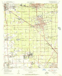
1949 Map of Anaheim
USGS Topo · Published 1956About this map
Agricultural groves and emerging suburban grids define this post-war landscape across Anaheim, Fullerton, and Garden Grove. The era's aviation and military footprint is prominent at the Fullerton Municipal Airport and the Naval Reservation containing Haster Field, while the remnants of wartime infrastructure appear at a POW Camp (Aband) near the Santa Ana River. Social and cultural hubs of the late 1940s are visible through landmarks like the Garden Grove Sanatorium, Santa Ana Junior College, and the Melrose Abbey Mausoleum. Extensive flood control efforts are documented via numerous Flood Control Settling Basins and the Carbon Canyon Wash. Smaller settlements like Colonia Independencia and Colonia Manzanillo sit alongside major rail lines including the Atchison Topeka and Santa Fe and the Pacific Electric.
Find a feature on this map
101 named features on this map. Tap any name to fly to it.
Don’t see what you’re looking for? This feature index may not catch every label — zoom into the map to look around manually.
Map Details
Editions of this 1949 Anaheim Map
This is the sole edition of this map. No revisions or reprints were ever made.
Other maps of this area

1896 · Santa Ana
USGS Topo · 1:62,500

1896 · Anaheim
USGS Topo · 1:62,500

1896 · Las Bolsas
USGS Topo · 1:62,500

1896 · Downey
USGS Topo · 1:62,500

1898 · Anaheim
USGS Topo · 1:62,500

1899 · Downey
USGS Topo · 1:62,500

1901 · Southern California Sheet No. 1
USGS Topo · 1:250,000

1901 · Santa Ana
USGS Topo · 1:62,500

1901 · Anaheim
USGS Topo · 1:62,500

1902 · Downey
USGS Topo · 1:62,500