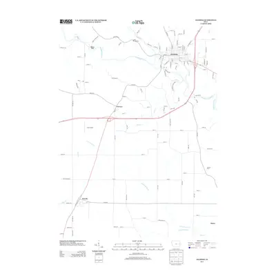
2013 Map of Anamosa
USGS Topo · Published 2013About this map
Anamosa serves as the focal point of this Jones County survey, situated along a sharp bend in the Wapsipinicon River. The landscape is defined by the river’s winding course, which passes by the Wapsipinicon State Park and flows beneath the Lower Road Bridge. To the west, the settlement of Stone City is nestled near the confluence of Buffalo Cr and the main river channel, while the smaller hamlets of Fairview and Martelle are connected by a network of rural roads traversing the southern agricultural plains. Local transit and infrastructure are further marked by Lerchs Airport and the crossroads at Morley. The mapping of several smaller waterways, including Dutch Cr and the N Fork Walnut Cr, highlights the drainage patterns that have historically influenced the region's farmstead locations and early settlement development.
Find a feature on this map
108 named features on this map. Tap any name to fly to it.
Don’t see what you’re looking for? This feature index may not catch every label — zoom into the map to look around manually.
Map Details
Editions of this 2013 Anamosa Map
This is the sole edition of this map. No revisions or reprints were ever made.
Other maps of this area

1889 · Tipton
USGS Topo · 1:62,500

1890 · Tipton
USGS Topo · 1:62,500

1890 · Anamosa
USGS Topo · 1:62,500

1891 · Monticello
USGS Topo · 1:62,500

1891 · Mechanicsville
USGS Topo · 1:62,500

1894 · Mechanicsville
USGS Topo · 1:62,500

1900 · Anamosa
USGS Topo · 1:125,000

1901 · Stanwood
USGS Topo · 1:125,000

1958 · Davenport
USGS Topo · 1:250,000

1959 · Dubuque
USGS Topo · 1:250,000