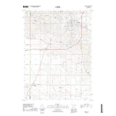
2018 Map of Anamosa
USGS Topo · Published 2018About this map
Anamosa serves as the regional hub in this Jones County landscape, where the Wapsipinicon River carves a winding path through the limestone-rich terrain. The map details the historic quarries of Stone City, a community defined by its proximity to the river and the Buffalo Creek confluence. Throughout the surrounding countryside, a high density of rural burial grounds provides a deep record for local genealogists, including Holy Cross Cem, Boot Hill Cem, and the Wilcox Cem near Fairview. The southern portion of the survey captures the small settlement of Martelle near the Linn County line, marking a shift toward the headwaters of Elbow Cr and the various forks of Walnut Cr. Numerous local transit corridors like Stone City Rd X28 and the Lower Road Bridge illustrate how these disconnected hamlets remain stitched together across the undulating Iowa hills.
Find a feature on this map
35 named features on this map. Tap any name to fly to it.
Don’t see what you’re looking for? This feature index may not catch every label — zoom into the map to look around manually.
Map Details
Editions of this 2018 Anamosa Map
This is the sole edition of this map. No revisions or reprints were ever made.
Other maps of this area

1889 · Tipton
USGS Topo · 1:62,500

1890 · Tipton
USGS Topo · 1:62,500

1890 · Anamosa
USGS Topo · 1:62,500

1891 · Monticello
USGS Topo · 1:62,500

1891 · Mechanicsville
USGS Topo · 1:62,500

1894 · Mechanicsville
USGS Topo · 1:62,500

1900 · Anamosa
USGS Topo · 1:125,000

1901 · Stanwood
USGS Topo · 1:125,000

1958 · Davenport
USGS Topo · 1:250,000

1959 · Dubuque
USGS Topo · 1:250,000