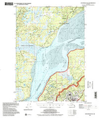
1994 Map of Anchorage B-8
USGS Topo · Published 2002About this map
The National Historic Trail (Iditarod) cuts across the northern terrain of this map, tracing a historic path through the landscape near the settlement of Knik. This area serves as a primary hub for mushing history, anchored by the Knik Museum and Mushers Hall of Fame. The geography is defined by the expansive mudflats of the Knik Arm, which separates the Goose Bay State Game Refuge from the heavy military presence to the south.
Find a feature on this map
65 named features on this map. Tap any name to fly to it.
Don’t see what you’re looking for? This feature index may not catch every label — zoom into the map to look around manually.
Map Details
Editions of this 1994 Anchorage B-8 Map
This is the sole edition of this map. No revisions or reprints were ever made.
Other maps of this area

1949 · Tyonek
USGS Topo · 1:250,000

1950 · Anchorage C-8
USGS Topo · 1:63,360

1950 · Anchorage C-7
USGS Topo · 1:63,360

1951 · Anchorage
USGS Topo · 1:250,000

1951 · Tyonek
USGS Topo · 1:250,000

1951 · Anchorage C-7
USGS Topo · 1:63,360

1951 · Tyonek A-1
USGS Topo · 1:63,360

1952 · Anchorage C-7
USGS Topo · 1:63,360

1952 · Anchorage C-8
USGS Topo · 1:63,360

1952 · Tyonek C-1
USGS Topo · 1:63,360