
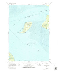
1951 Map of Tyonek A-1
USGS Topo · Published 1971About this map
Fire Island sits at the convergence of several major Alaskan waterways, serving as a critical navigational hub for maritime traffic entering the upper Cook Inlet. Surveyed in the early 1950s, this area captures a landscape defined by expansive tidal flats and tactical strategic locations near the growing hub of Anchorage. The island is marked by its rugged shoreline features like West Pt and North Pt, alongside aviation infrastructure including a Landing Strip and two critical beacons, Fire Island Light and Race Point Light.
Find a feature on this map
25 named features on this map. Tap any name to fly to it.
Don’t see what you’re looking for? This feature index may not catch every label — zoom into the map to look around manually.
Map Details
Editions of this 1951 Tyonek A-1 Map
2 editions found
Other maps of this area

1944 · Kenai
USGS Topo · 1:250,000

1949 · Tyonek
USGS Topo · 1:250,000

1950 · Kenai
USGS Topo · 1:250,000

1951 · Seward
USGS Topo · 1:250,000

1951 · Anchorage
USGS Topo · 1:250,000

1951 · Tyonek
USGS Topo · 1:250,000

1951 · Kenai D-1
USGS Topo · 1:63,360

1951 · Kenai D-2
USGS Topo · 1:63,360

1951 · Tyonek A-2
USGS Topo · 1:63,360

1951 · Seward D-8
USGS Topo · 1:63,360