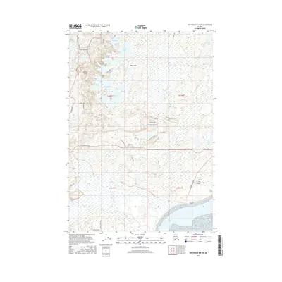
2016 Map of Anchorage B-8 NW
USGS Topo · Published 2016About this map
Goose Bay and its surrounding wetlands anchor the southern edge of this landscape, where the waters of Elnen Ghilget meet the inlet. The inland terrain is defined by a dense network of lakes, including Big Lake, Stephan Lake, and Sevenmile Lake, connected by numerous small drainages like Goose Cr. This area shows a distinctive pattern of homesteading and early aviation, evidenced by Brown's Homestead Airport in the northwest and Goose Bay Airport near the coast. A modern grid of residential roads, such as Blarney Stone Drive, Bluebill Avenue, and New Homesteader Avenue, cuts through the wilderness between Point McKenzie Road and Knik-Goose Bay Road. The transition from the tidal flats near Ts'es T'unt to the wooded lake country highlights the varied geography of the Matanuska-Susitna region.
Find a feature on this map
46 named features on this map. Tap any name to fly to it.
Don’t see what you’re looking for? This feature index may not catch every label — zoom into the map to look around manually.
Map Details
Editions of this 2016 Anchorage B-8 NW Map
This is the sole edition of this map. No revisions or reprints were ever made.
Other maps of this area

1949 · Tyonek
USGS Topo · 1:250,000

1950 · Anchorage C-8
USGS Topo · 1:63,360

1951 · Anchorage
USGS Topo · 1:250,000

1951 · Tyonek
USGS Topo · 1:250,000

1952 · Anchorage C-8
USGS Topo · 1:63,360

1952 · Tyonek C-1
USGS Topo · 1:63,360

1952 · Anchorage B-8
USGS Topo · 1:63,360

1953 · Anchorage B-8
USGS Topo · 1:63,360

1958 · Tyonek B-1
USGS Topo · 1:63,360

1958 · Tyonek C-1
USGS Topo · 1:63,360