
1958 Map of Tyonek C-1
USGS Topo · Published 1962About this map
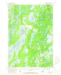
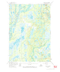
The Susitna River and its intricate drainage system dominate this late 1950s landscape, where the Kroto Slough and Kroto Creek weave through the western lowlands. Transportation in this subarctic region is defined by the vital corridor of The Alaska Railroad in the northeast, supported by the Willow Station Airstrip and a nearby Port. The terrain is characterized by a dense network of lakes, including the expansive Red Shirt Lake and the smaller Papoose Twins, many of which served as remote landing spots for bush pilots and early homesteaders. Evidence of interior access is found along the Tractor Trail cutting through the center of the quadrangle. Sparse Cabins are noted along several waterways, marking the early stages of seasonal and year-round settlement before the extensive development of the Matanuska-Susitna Valley. The map also identifies Radar Hill, indicating a mid-century military or navigational presence on the height of land near Gene Lake.
Find a feature on this map
35 named features on this map. Tap any name to fly to it.
Don’t see what you’re looking for? This feature index may not catch every label — zoom into the map to look around manually.
Map Details
Editions of this 1958 Tyonek C-1 Map
3 editions found
Other maps of this area

1949 · Tyonek
USGS Topo · 1:250,000

1949 · Anchorage D-8
USGS Topo · 1:63,360

1950 · Anchorage C-8
USGS Topo · 1:63,360

1951 · Anchorage
USGS Topo · 1:250,000

1951 · Tyonek
USGS Topo · 1:250,000

1951 · Anchorage D-8
USGS Topo · 1:63,360

1952 · Anchorage C-8
USGS Topo · 1:63,360

1952 · Tyonek D-1
USGS Topo · 1:63,360

1952 · Tyonek C-1
USGS Topo · 1:63,360

1952 · Anchorage D-8
USGS Topo · 1:63,360