
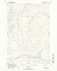
1951 Map of Anchorage D-8
USGS Topo · Published 1961About this map
Kashwitna River and its major tributaries, including the North Fork and Little Willow Creek, dominate this Alaskan landscape as it was documented in the early 1950s. The area is characterized by an intricate network of waterways like Rogers Creek and Peters Creek flowing through terrain marked by surveyed peaks such as VABM 3168 Willow and VABM Peters 1231. Human presence is minimal, defined primarily by a remote Cabin and infrastructure suited for the environment. A primitive Road and a Sled Road near Purches Creek provide the only land-based transport routes through the river basins. This survey captures a moment before significant modern development, showing the natural drainage patterns of Willow Creek and Deception Creek as they existed mid-century.
Find a feature on this map
15 named features on this map. Tap any name to fly to it.
Don’t see what you’re looking for? This feature index may not catch every label — zoom into the map to look around manually.
Map Details
Editions of this 1951 Anchorage D-8 Map
2 editions found
Other maps of this area

1949 · Tyonek
USGS Topo · 1:250,000

1949 · Anchorage D-7
USGS Topo · 1:63,360

1949 · Anchorage D-8
USGS Topo · 1:63,360

1950 · Talkeetna Mountains
USGS Topo · 1:250,000

1950 · Talkeetna
USGS Topo · 1:250,000

1950 · Anchorage C-8
USGS Topo · 1:63,360

1950 · Anchorage C-7
USGS Topo · 1:63,360

1950 · Talkeetna Mountains A-6
USGS Topo · 1:63,360

1951 · Talkeetna
USGS Topo · 1:250,000

1951 · Anchorage
USGS Topo · 1:250,000