
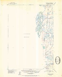
1952 Map of Tyonek D-1
USGS Topo · Published 1952About this map
The Alaska Railroad serves as the primary artery through this Alaskan landscape, running parallel to the braided channels of the Susitna River. The map highlights a period of infrastructure development where rail access was paramount to small settlements like Caswell and Kashwitna. The presence of the Willow Station Airstrip and a Gravel Pit near the tracks suggests the localized industry and logistical needs of the era.
Find a feature on this map
13 named features on this map. Tap any name to fly to it.
Don’t see what you’re looking for? This feature index may not catch every label — zoom into the map to look around manually.
Map Details
Editions of this 1952 Tyonek D-1 Map
2 editions found
Other maps of this area

1949 · Tyonek
USGS Topo · 1:250,000

1949 · Anchorage D-8
USGS Topo · 1:63,360

1950 · Talkeetna Mountains
USGS Topo · 1:250,000

1950 · Talkeetna
USGS Topo · 1:250,000

1950 · Anchorage C-8
USGS Topo · 1:63,360

1950 · Talkeetna Mountains A-6
USGS Topo · 1:63,360

1951 · Talkeetna
USGS Topo · 1:250,000

1951 · Anchorage
USGS Topo · 1:250,000

1951 · Tyonek
USGS Topo · 1:250,000

1951 · Anchorage D-8
USGS Topo · 1:63,360