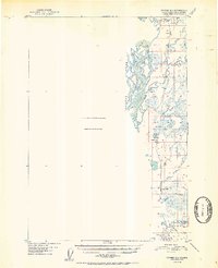
1952 Map of Tyonek D-1
USGS Topo · Published 1952About this map
The Alaska Railroad serves as the primary spine of development through this portion of the Susitna Valley, tracing a narrow corridor of human activity amidst a landscape largely unmapped in the early 1950s. While much of the western quadrangle is noted as having no compilation available due to insufficient photo coverage, the eastern edge reveals a string of rail-dependent settlements and infrastructure. Small outposts like Caswell and Kashwitna are positioned along the tracks, supported by features like the Willow Station Airstrip and a Gravel Pit. The drainage patterns are dominated by the braided Susitna River and its numerous tributaries, including the Kashwitna River, Willow Creek, and Sheep Creek. This survey captures a moment when territorial Alaska relied heavily on single-track rail connections to bridge the wilderness between growing coastal hubs and the interior.
Find a feature on this map
14 named features on this map. Tap any name to fly to it.
Don’t see what you’re looking for? This feature index may not catch every label — zoom into the map to look around manually.
Map Details
Editions of this 1952 Tyonek D-1 Map
2 editions found

Other maps of this area

1949 · Tyonek
USGS Topo · 1:250,000

1949 · Anchorage D-8
USGS Topo · 1:63,360

1950 · Talkeetna Mountains
USGS Topo · 1:250,000

1950 · Talkeetna
USGS Topo · 1:250,000

1950 · Anchorage C-8
USGS Topo · 1:63,360

1950 · Talkeetna Mountains A-6
USGS Topo · 1:63,360

1951 · Talkeetna
USGS Topo · 1:250,000

1951 · Anchorage
USGS Topo · 1:250,000

1951 · Tyonek
USGS Topo · 1:250,000

1951 · Anchorage D-8
USGS Topo · 1:63,360