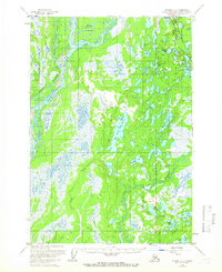
1958 Map of Tyonek C-1
USGS Topo · Published 1966About this map
The Alaska Railroad corridor serves as the primary spine of development in this subarctic landscape during the late 1950s, anchoring the settlement of Willow. Nearby, the Willow Station Landing Strip and Radar Hill indicate the era's reliance on both rail and air transport for regional connectivity. The territory is dominated by an intricate network of waterways, defined by the broad Susitna River and its braids around the Delta Islands, alongside the Kroto Slough and Little Susitna River.
Find a feature on this map
35 named features on this map. Tap any name to fly to it.
Don’t see what you’re looking for? This feature index may not catch every label — zoom into the map to look around manually.
Map Details
Editions of this 1958 Tyonek C-1 Map
3 editions found

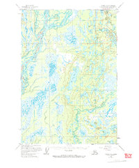
Other maps of this area

1949 · Tyonek
USGS Topo · 1:250,000

1949 · Anchorage D-8
USGS Topo · 1:63,360

1950 · Anchorage C-8
USGS Topo · 1:63,360

1951 · Anchorage
USGS Topo · 1:250,000

1951 · Tyonek
USGS Topo · 1:250,000

1951 · Anchorage D-8
USGS Topo · 1:63,360

1952 · Anchorage C-8
USGS Topo · 1:63,360

1952 · Tyonek D-1
USGS Topo · 1:63,360

1952 · Tyonek C-1
USGS Topo · 1:63,360

1952 · Anchorage D-8
USGS Topo · 1:63,360