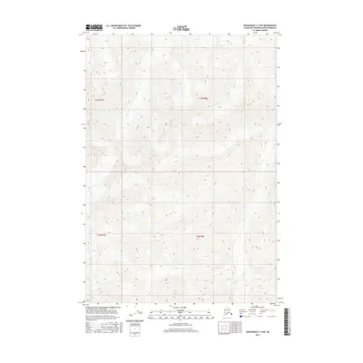
2016 Map of Anchorage C-3 NW
USGS Topo · Published 2016About this map
Monument Cr and Gravel Cr carve through this high-elevation region of the Alaska interior within the Matanuska-Susitna Borough. This 2016 survey highlights a landscape largely defined by its natural drainage patterns and the administrative grid of the Public Land Survey System, including t19n r8e and t18n r7e. The map illustrates the complex topography of the Talkeetna Mountains area before modern development, focusing on the preservation of hydrographic data such as the headwaters and seasonal flows of local creeks. Researchers can examine the intersections of historical township boundaries and the untouched terrain of the Alaskan wilderness during the early 21st century.
Find a feature on this map
6 named features on this map. Tap any name to fly to it.
Don’t see what you’re looking for? This feature index may not catch every label — zoom into the map to look around manually.
Map Details
Editions of this 2016 Anchorage C-3 NW Map
This is the sole edition of this map. No revisions or reprints were ever made.
Other maps of this area

1948 · Anchorage D-3
USGS Topo · 1:63,360

1948 · Anchorage D-4
USGS Topo · 1:63,360

1951 · Anchorage
USGS Topo · 1:250,000

1952 · Anchorage D-4
USGS Topo · 1:63,360

1952 · Anchorage D-3
USGS Topo · 1:63,360

1960 · Anchorage C-3
USGS Topo · 1:63,360

1960 · Anchorage C-4
USGS Topo · 1:63,360

1962 · Anchorage
USGS Topo · 1:250,000

1979 · Anchorage
USGS Topo · 1:250,000

1993 · Anchorage C-3
USGS Topo · 1:63,360