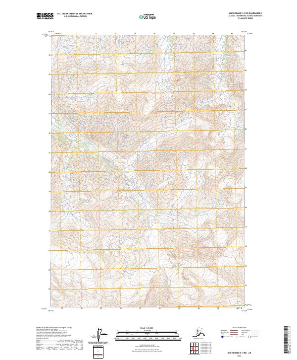
2023 Map of Anchorage C-4 NE
USGS Topo · Published 2023About this map
Metal Creek Glacier anchors the southern reaches of this mountainous Alaskan landscape, where glacial ice meets the complex drainage systems of the Chugach Mountains. The high-altitude terrain is defined by the sharp descents of Coal Creek and Ninemile Creek, which cut through the steep topography of t19n r7e and surrounding townships. Riley Creek flows through the northwestern corner, illustrating the network of glacial runoff and seasonal melt that carves the deep valleys of the Matanuska-Susitna region. The lack of road development and human settlement markers on this sheet emphasizes a landscape dominated entirely by ice, water, and elevation, offering a precise modern record of glacial positioning and hydrological patterns in a rapidly changing subarctic environment.
Find a feature on this map
8 named features on this map. Tap any name to fly to it.
Don’t see what you’re looking for? This feature index may not catch every label — zoom into the map to look around manually.
Map Details
Editions of this 2023 Anchorage C-4 NE Map
This is the sole edition of this map. No revisions or reprints were ever made.
Other maps of this area

1948 · Anchorage D-3
USGS Topo · 1:63,360

1948 · Anchorage D-4
USGS Topo · 1:63,360

1951 · Anchorage
USGS Topo · 1:250,000

1952 · Anchorage D-4
USGS Topo · 1:63,360

1952 · Anchorage D-3
USGS Topo · 1:63,360

1960 · Anchorage C-3
USGS Topo · 1:63,360

1960 · Anchorage C-4
USGS Topo · 1:63,360

1962 · Anchorage
USGS Topo · 1:250,000

1979 · Anchorage
USGS Topo · 1:250,000

1993 · Anchorage C-3
USGS Topo · 1:63,360