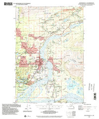
1994 Map of Anchorage C-6
USGS Topo · Published 2002About this map
The Matanuska Valley serves as a hub of agriculture and industry in this 1994 snapshot of Southcentral Alaska. The town of Palmer is the central anchor, showing a developed grid including the State Fairgrounds, Sherrod Sch, and the Municipal Airport. This survey captures the transition from the valley's historic coal mining heritage at the Wishbone Hill area—where labels for the Eska Mine, Jonesville Mine, and Buffalo Mine persist—to a landscape increasingly defined by recreation and residential expansion.
Find a feature on this map
110 named features on this map. Tap any name to fly to it.
Don’t see what you’re looking for? This feature index may not catch every label — zoom into the map to look around manually.
Map Details
Editions of this 1994 Anchorage C-6 Map
This is the sole edition of this map. No revisions or reprints were ever made.
Other maps of this area

1949 · Anchorage D-5
USGS Topo · 1:63,360

1949 · Anchorage D-7
USGS Topo · 1:63,360

1950 · Anchorage D-6
USGS Topo · 1:63,360

1950 · Anchorage C-7
USGS Topo · 1:63,360

1951 · Anchorage
USGS Topo · 1:250,000

1951 · Anchorage C-6
USGS Topo · 1:63,360

1951 · Anchorage C-7
USGS Topo · 1:63,360

1951 · Anchorage C-5
USGS Topo · 1:63,360

1951 · Anchorage D-7
USGS Topo · 1:63,360

1952 · Anchorage C-7
USGS Topo · 1:63,360