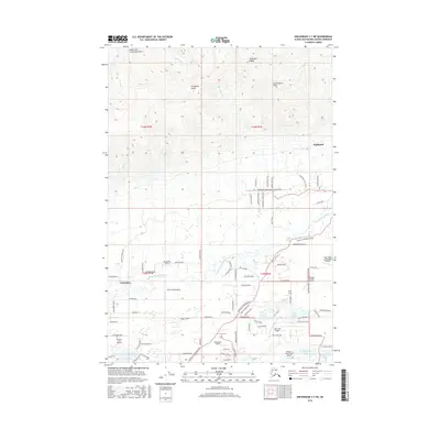
2016 Map of Anchorage C-7 NE
USGS Topo · Published 2016About this map
Tanaina and the mountain community of Fishhook define the inhabited landscape of this 2016 survey, situated where the northern Matanuska-Susitna valley meets the rising foothills. The geography is characterized by a transition from the lower developed areas around Tanaina to the high-elevation drainage of West Fork Grubstake Gulch in the north. This modern topography records the contemporary footprint of roads and residential growth that has increasingly defined the region since the late 20th century. Local researchers can examine the boundaries of t18n r1w and t19n r1e, which anchor the land surveys of this rapidly changing subarctic corridor.
Find a feature on this map
7 named features on this map. Tap any name to fly to it.
Don’t see what you’re looking for? This feature index may not catch every label — zoom into the map to look around manually.
Map Details
Editions of this 2016 Anchorage C-7 NE Map
This is the sole edition of this map. No revisions or reprints were ever made.
Other maps of this area

1949 · Anchorage D-7
USGS Topo · 1:63,360

1950 · Anchorage D-6
USGS Topo · 1:63,360

1950 · Anchorage C-7
USGS Topo · 1:63,360

1951 · Anchorage
USGS Topo · 1:250,000

1951 · Anchorage C-6
USGS Topo · 1:63,360

1951 · Anchorage C-7
USGS Topo · 1:63,360

1951 · Anchorage D-7
USGS Topo · 1:63,360

1952 · Anchorage C-7
USGS Topo · 1:63,360

1952 · Anchorage D-7
USGS Topo · 1:63,360

1952 · Anchorage D-6
USGS Topo · 1:63,360