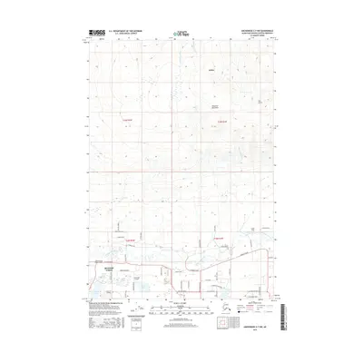
2016 Map of Anchorage C-7 NW
USGS Topo · Published 2016About this map
The Little Susitna River meanders through this portion of the Matanuska-Susitna Borough, defining a landscape of low-lying wetlands and aviation-centric settlements. This 2016 survey captures the residential expansion of Meadow Lakes and the southern reaches of Willow, where a dense network of local roads like Pittman Road and Schrock Road serve a community integrated with the wilderness. The terrain is notably marked by private aviation infrastructure, including the Valley Flying Crown Airport, June Lake Airpark, and Todds Strip, reflecting the region's reliance on bush flying. To the north, the elevation rises toward the Talkeetna Mountains, where drainage features like W Fork Sawmill Cr and the steep Wet Gulch carve into the upland slopes. Named water bodies such as Totuck Lake, Island Lake, and Chignaki Pond are interspersed among the property lines and landing strips of the valley floor.
Find a feature on this map
55 named features on this map. Tap any name to fly to it.
Don’t see what you’re looking for? This feature index may not catch every label — zoom into the map to look around manually.
Map Details
Editions of this 2016 Anchorage C-7 NW Map
This is the sole edition of this map. No revisions or reprints were ever made.
Other maps of this area

1949 · Anchorage D-7
USGS Topo · 1:63,360

1949 · Anchorage D-8
USGS Topo · 1:63,360

1950 · Anchorage C-8
USGS Topo · 1:63,360

1950 · Anchorage C-7
USGS Topo · 1:63,360

1951 · Anchorage
USGS Topo · 1:250,000

1951 · Anchorage C-7
USGS Topo · 1:63,360

1951 · Anchorage D-8
USGS Topo · 1:63,360

1951 · Anchorage D-7
USGS Topo · 1:63,360

1952 · Anchorage C-7
USGS Topo · 1:63,360

1952 · Anchorage D-7
USGS Topo · 1:63,360