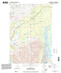
1993 Map of Anchorage D-1
USGS Topo · Published 2001About this map
The Eureka Roadhouse serves as a critical waypoint along the Glenn Highway in this 1993 study of the Matanuska-Susitna region. This landscape is defined by its dramatic drainage patterns, where the Matanuska River and its East Fork cut through the terrain south of the Glenn Highway, while the massive Nelchina Glacier and Nelchina River dominate the southeastern corner. A legacy of early aviation and communication is evident in the multiple Landing Strips and a Radio Facility near Knob Lake. The area's transition from high mountain passes like Belanger Pass to the lake-strewn flats containing Tahneta Lake, Shallow Lake, and Long Lake illustrates the complex glacial topography that dictated the route of the highway and the location of isolated Cabins.
Find a feature on this map
42 named features on this map. Tap any name to fly to it.
Don’t see what you’re looking for? This feature index may not catch every label — zoom into the map to look around manually.
Map Details
Editions of this 1993 Anchorage D-1 Map
This is the sole edition of this map. No revisions or reprints were ever made.
Other maps of this area

1948 · Anchorage D-2
USGS Topo · 1:63,360

1948 · Anchorage D-1
USGS Topo · 1:63,360

1949 · Talkeetna Mountains A-1
USGS Topo · 1:63,360

1949 · Gulkana A-6
USGS Topo · 1:63,360

1949 · Valdez D-8
USGS Topo · 1:63,360

1950 · Talkeetna Mountains
USGS Topo · 1:250,000

1951 · Gulkana
USGS Topo · 1:250,000

1951 · Anchorage
USGS Topo · 1:250,000

1951 · Anchorage D-1
USGS Topo · 1:63,360

1952 · Valdez D-8
USGS Topo · 1:63,360