
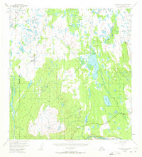
1949 Map of Gulkana A-6
USGS Topo · Published 1964About this map
Slide Mountain anchors the southern portion of this landscape, its steep contours giving way to a vast network of water bodies and marshlands. This 1949 survey illustrates the early infrastructure of the Copper River Meridian, centered on the corridor of the Glenn Highway. Human activity is concentrated along this route, notably at the Mendeltna Lodge, which serves as a remote outpost in an area otherwise defined by its intricate hydrology.
Find a feature on this map
41 named features on this map. Tap any name to fly to it.
Don’t see what you’re looking for? This feature index may not catch every label — zoom into the map to look around manually.
Map Details
Editions of this 1949 Gulkana A-6 Map
2 editions found
Other maps of this area

1948 · Anchorage D-1
USGS Topo · 1:63,360

1949 · Gulkana A-5
USGS Topo · 1:63,360

1949 · Talkeetna Mountains A-1
USGS Topo · 1:63,360

1949 · Valdez D-8
USGS Topo · 1:63,360

1949 · Valdez D-7
USGS Topo · 1:63,360

1950 · Talkeetna Mountains
USGS Topo · 1:250,000

1950 · Gulkana B-6
USGS Topo · 1:63,360

1951 · Gulkana
USGS Topo · 1:250,000

1951 · Valdez D-7
USGS Topo · 1:63,360

1951 · Anchorage
USGS Topo · 1:250,000