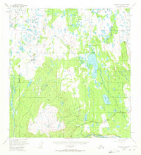
1949 Map of Gulkana A-6
USGS Topo · Published 1972About this map
Slide Mountain dominates the southern landscape of this interior wilderness, its massive slopes giving way to a complex network of glacial lakes and river systems. By the late 1940s, the Glenn Highway provided the primary corridor for travel, passing the Mendeltna Lodge and Mendeltna Springs near the eastern margin. The terrain is defined by its water, from the winding Nelchina River and Little Nelchina River to isolated pools like Phanaria Lake and Fossil Lake. Small-scale aviation infrastructure is noted at the Seaplane Base on Snowshoe Lake, a vital link in a region where road access was limited to a single main artery. Dozens of named water bodies, such as Old Man Lake and Nickoli Lake, suggest a landscape shaped by seasonal melt and persistent wetlands, punctuated by high-elevation survey markers like VABM Windy.
Find a feature on this map
41 named features on this map. Tap any name to fly to it.
Don’t see what you’re looking for? This feature index may not catch every label — zoom into the map to look around manually.
Map Details
Editions of this 1949 Gulkana A-6 Map
2 editions found
Other maps of this area

1948 · Anchorage D-1
USGS Topo · 1:63,360

1949 · Gulkana A-5
USGS Topo · 1:63,360

1949 · Talkeetna Mountains A-1
USGS Topo · 1:63,360

1949 · Gulkana A-6
USGS Topo · 1:63,360

1949 · Valdez D-8
USGS Topo · 1:63,360

1949 · Valdez D-7
USGS Topo · 1:63,360

1950 · Talkeetna Mountains
USGS Topo · 1:250,000

1950 · Gulkana B-6
USGS Topo · 1:63,360

1951 · Gulkana
USGS Topo · 1:250,000

1951 · Valdez D-7
USGS Topo · 1:63,360