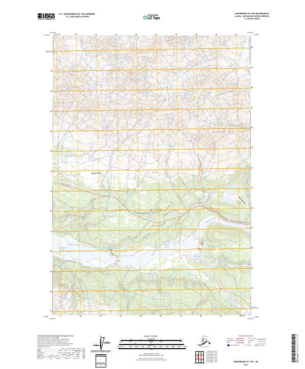
2023 Map of Anchorage D-3 SW
USGS Topo · Published 2023About this map
The Matanuska River carves through the heart of the Matanuska Valley in this modern survey of south-central Alaska. This landscape is defined by the dramatic elevation change between the braided riverbed and the towering heights of Anthracite Ridge and Strelshla Mtn to the north. The small community of Glacier View is positioned along the Glenn Highway, which serves as the primary artery for travel through this high-altitude corridor. Numerous glacial-fed tributaries including Tukmakna Creek, Purinton Creek, and Muddy Creek flow southward from the mountains toward the main river channel.
Find a feature on this map
35 named features on this map. Tap any name to fly to it.
Don’t see what you’re looking for? This feature index may not catch every label — zoom into the map to look around manually.
Map Details
Editions of this 2023 Anchorage D-3 SW Map
This is the sole edition of this map. No revisions or reprints were ever made.
Other maps of this area

1948 · Anchorage D-3
USGS Topo · 1:63,360

1948 · Anchorage D-4
USGS Topo · 1:63,360

1951 · Anchorage
USGS Topo · 1:250,000

1952 · Anchorage D-4
USGS Topo · 1:63,360

1952 · Anchorage D-3
USGS Topo · 1:63,360

1960 · Anchorage C-3
USGS Topo · 1:63,360

1960 · Anchorage C-4
USGS Topo · 1:63,360

1962 · Anchorage
USGS Topo · 1:250,000

1979 · Anchorage
USGS Topo · 1:250,000

1993 · Anchorage C-3
USGS Topo · 1:63,360