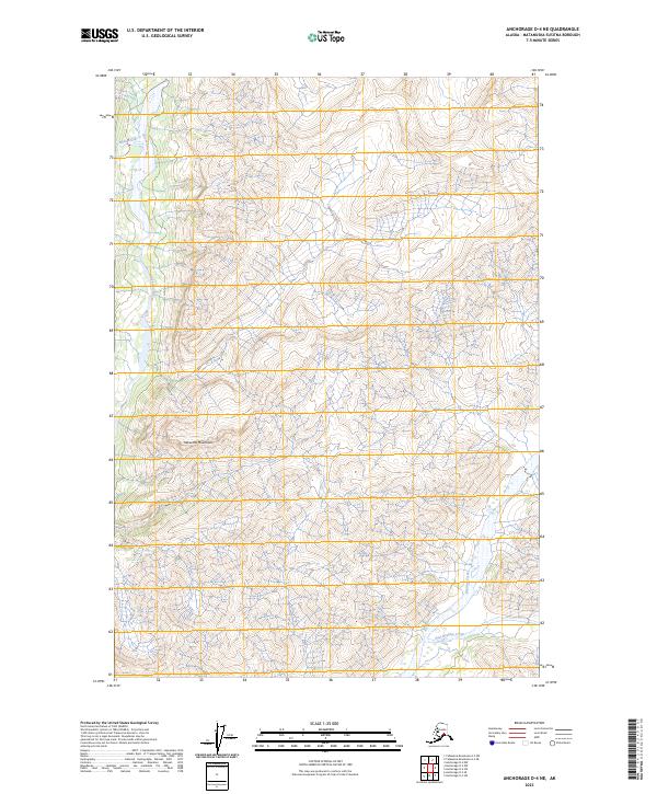
2023 Map of Anchorage D-4 NE
USGS Topo · Published 2023About this map
Chickaloon River carves through the high elevations of the Talkeetna Mountains, defining the drainage patterns of this remote northern landscape. The terrain is characterized by steep contour gradients and a network of high-altitude waterways, including Moss Creek in the northwest and the systems of Boulder Creek and East Boulder Creek in the southeast.
Find a feature on this map
9 named features on this map. Tap any name to fly to it.
Don’t see what you’re looking for? This feature index may not catch every label — zoom into the map to look around manually.
Map Details
Editions of this 2023 Anchorage D-4 NE Map
This is the sole edition of this map. No revisions or reprints were ever made.
Other maps of this area

1948 · Anchorage D-3
USGS Topo · 1:63,360

1948 · Anchorage D-4
USGS Topo · 1:63,360

1950 · Talkeetna Mountains
USGS Topo · 1:250,000

1951 · Anchorage
USGS Topo · 1:250,000

1951 · Talkeetna Mountains A-3
USGS Topo · 1:63,360

1952 · Anchorage D-4
USGS Topo · 1:63,360

1952 · Anchorage D-3
USGS Topo · 1:63,360
1952 · Talkeetna Mountains A-3
USGS Topo · 1:63,360

1954 · Talkeetna Mountains
USGS Topo · 1:250,000
1957 · Talkeetna Mountains
USGS Topo · 1:250,000