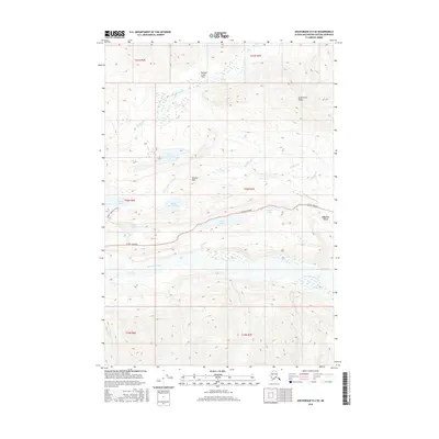
2016 Map of Anchorage D-4 SE
USGS Topo · Published 2016About this map
Glenn Highway serves as the primary artery through this Alaskan landscape, connecting the small settlement at Glacier View with the surrounding wilderness. The terrain is defined by dramatic elevation changes, rising from the Matanuska River valley toward the heights of Anthracite Ridge and Wardies Peak. This 2016 survey illustrates a corridor where transportation infrastructure and natural water systems are closely intertwined. Numerous alpine water bodies, including Long Lake, Wiener Lake, and Bonnie Lake, dot the area north of the highway. The Bonnie Lake Access Road provides one of the few points of interior access into the high country. In the northern reaches, the Boulder Creek Flats indicate a shift in the drainage patterns of Boulder Creek, reflecting the complex glacial hydrology characteristic of the Matanuska-Susitna region.
Find a feature on this map
25 named features on this map. Tap any name to fly to it.
Don’t see what you’re looking for? This feature index may not catch every label — zoom into the map to look around manually.
Map Details
Editions of this 2016 Anchorage D-4 SE Map
This is the sole edition of this map. No revisions or reprints were ever made.
Other maps of this area

1948 · Anchorage D-3
USGS Topo · 1:63,360

1948 · Anchorage D-4
USGS Topo · 1:63,360

1951 · Anchorage
USGS Topo · 1:250,000

1952 · Anchorage D-4
USGS Topo · 1:63,360

1952 · Anchorage D-3
USGS Topo · 1:63,360

1960 · Anchorage C-3
USGS Topo · 1:63,360

1960 · Anchorage C-4
USGS Topo · 1:63,360

1962 · Anchorage
USGS Topo · 1:250,000

1979 · Anchorage
USGS Topo · 1:250,000

1993 · Anchorage C-3
USGS Topo · 1:63,360