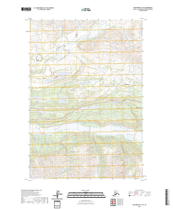
2023 Map of Anchorage D-4 SE
USGS Topo · Published 2023About this map
Anthracite Ridge dominates the northern skyline of this Alaskan landscape, overlooking the complex drainage systems of the Matanuska Valley. The area is defined by its dramatic relief, where Wardies Peak stands as a sentinel over a series of high-elevation water bodies including Rush Lake and Upper Bonnie Lake. Human activity and transport are concentrated along the southern corridor where the Glenn Highway follows the northern bank of the Matanuska River. This route connects the settlements of Chickaloon and Glacier View, providing access to the region's interior through specialized paths like the Bonnie Lake Access Road. The map reveals an intricate network of tributaries such as Black Shale Creek and Meadow Creek that feed into the valley floor, illustrating the geological forces that continue to shape this portion of the Matanuska-Susitna Borough.
Find a feature on this map
28 named features on this map. Tap any name to fly to it.
Don’t see what you’re looking for? This feature index may not catch every label — zoom into the map to look around manually.
Map Details
Editions of this 2023 Anchorage D-4 SE Map
This is the sole edition of this map. No revisions or reprints were ever made.
Other maps of this area

1948 · Anchorage D-3
USGS Topo · 1:63,360

1948 · Anchorage D-4
USGS Topo · 1:63,360

1951 · Anchorage
USGS Topo · 1:250,000

1952 · Anchorage D-4
USGS Topo · 1:63,360

1952 · Anchorage D-3
USGS Topo · 1:63,360

1960 · Anchorage C-3
USGS Topo · 1:63,360

1960 · Anchorage C-4
USGS Topo · 1:63,360

1962 · Anchorage
USGS Topo · 1:250,000

1979 · Anchorage
USGS Topo · 1:250,000

1993 · Anchorage C-3
USGS Topo · 1:63,360