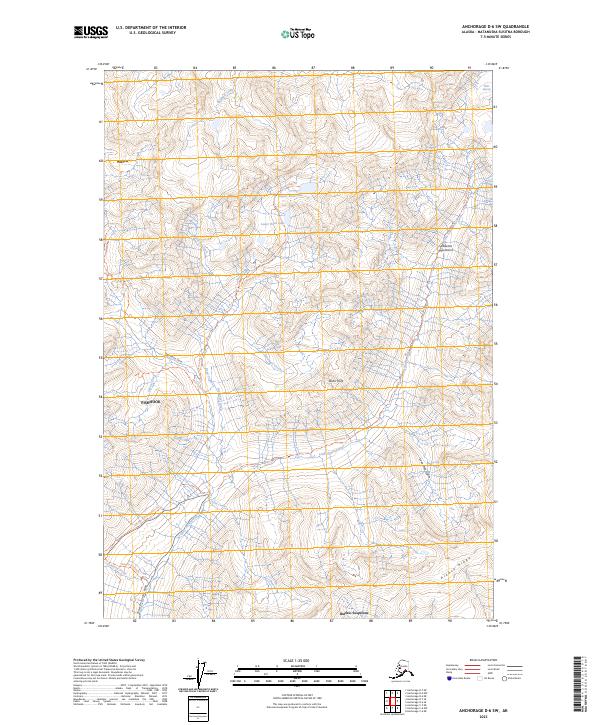
2023 Map of Anchorage D-6 SW
USGS Topo · Published 2023About this map
The Talkeetna Mountains define the northern terrain of this region, where the Mint Glacier feeds into a network of alpine creeks and lakes. The drainage system is anchored by the Little Susitna River, with Upper Reed Lake and Lower Reed Lake serving as central landmarks for those tracking the high-country landscape. Human movement through these peaks is evidenced by established routes like the Gold Mint Trl and the Reed Lakes Trl, which navigate the steep elevations near Idaho Peak.
Find a feature on this map
32 named features on this map. Tap any name to fly to it.
Don’t see what you’re looking for? This feature index may not catch every label — zoom into the map to look around manually.
Map Details
Editions of this 2023 Anchorage D-6 SW Map
This is the sole edition of this map. No revisions or reprints were ever made.
Other maps of this area

1949 · Anchorage D-7
USGS Topo · 1:63,360

1950 · Anchorage D-6
USGS Topo · 1:63,360

1950 · Anchorage C-7
USGS Topo · 1:63,360

1951 · Anchorage
USGS Topo · 1:250,000

1951 · Anchorage C-6
USGS Topo · 1:63,360

1951 · Anchorage C-7
USGS Topo · 1:63,360

1951 · Anchorage D-7
USGS Topo · 1:63,360

1952 · Anchorage C-7
USGS Topo · 1:63,360

1952 · Anchorage D-7
USGS Topo · 1:63,360

1952 · Anchorage D-6
USGS Topo · 1:63,360