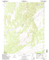
1994 Map of Anchorite Hills
USGS Topo · Published 1997About this map
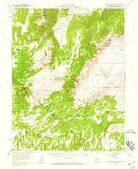
Toiyabe National Forest dominates this high-altitude landscape along the border of Nevada and California. The 1994 survey highlights the complex terrain of the Anchorite Hills and the northern reaches of the Excelsior Mountains, separated by high-desert features like Little Whisky Flat and Alkali Valley. A significant historical marker is the Von Schmidt Boundary (1873), which slices through the lower-left corner of the map, delineating the state line as surveyed in the late 19th century. The area is marked by several mineral extraction attempts, evidenced by numerous Prospects scattered near Long Valley and the northern ridges. Transportation is limited to rugged 4WD routes, including the one traversing Anchorite Pass, reflecting the area's isolated and utilitarian character at the end of the 20th century.
Find a feature on this map
17 named features on this map. Tap any name to fly to it.
Don’t see what you’re looking for? This feature index may not catch every label — zoom into the map to look around manually.
Map Details
Editions of this 1994 Anchorite Hills Map
This is the sole edition of this map. No revisions or reprints were ever made.
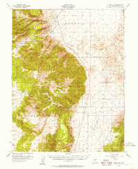
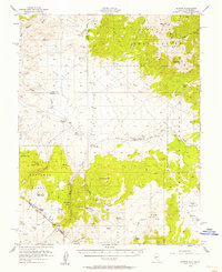
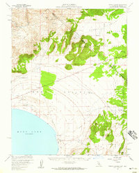
Other maps of this area

1909 · Hawthorne
USGS Topo · 1:250,000

1911 · Hawthorne
USGS Topo · 1:250,000

1915 · Hawthorne
USGS Topo · 1:250,000

1948 · Walker Lake
USGS Topo · 1:250,000
1955 · Powell Mtn
USGS Topo · 1:62,500
1956 · Aurora
USGS Topo · 1:62,500

1957 · Walker Lake
USGS Topo · 1:250,000
1958 · Trench Canyon
USGS Topo · 1:62,500
1958 · Huntoon Valley
USGS Topo · 1:62,500

1962 · Walker Lake
USGS Topo · 1:250,000