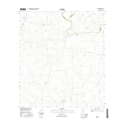
2016 Map of Ander
USGS Topo · Published 2016About this map
Ander serves as the central focal point for this rural landscape where Goliad, DeWitt, and Victoria Counties meet. The terrain is defined by a dense network of seasonal drainages, including the aptly named Hog-Thief Cr, Eighteenmile Cr, and Fifteenmile Cr, which carve through the coastal plain. The presence of several family-named burial sites, such as San Jose Cem, Franklin Cem, Danforth Cem, and Killibrew Cem, suggests a long-established ranching or farming community with deep generational roots.
Find a feature on this map
43 named features on this map. Tap any name to fly to it.
Don’t see what you’re looking for? This feature index may not catch every label — zoom into the map to look around manually.
Map Details
Editions of this 2016 Ander Map
This is the sole edition of this map. No revisions or reprints were ever made.
Other maps of this area

1953 · Beeville
USGS Topo · 1:250,000

1956 · Beeville
USGS Topo · 1:250,000

1960 · Beeville
USGS Topo · 1:250,000

1962 · Fannin
USGS Topo · 1:24,000

1962 · Hensley Lake
USGS Topo · 1:24,000

1962 · Goliad
USGS Topo · 1:24,000

1963 · Meyersville
USGS Topo · 1:24,000

1963 · Weesatche
USGS Topo · 1:24,000
1963 · Yorktown East
USGS Topo · 1:24,000
1963 · Mission Valley
USGS Topo · 1:24,000