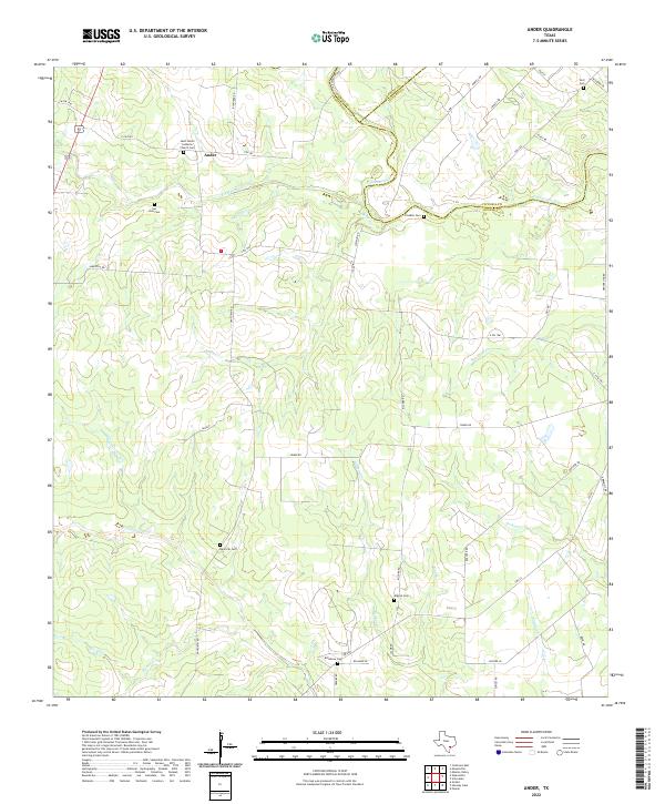
2022 Map of Ander
USGS Topo · Published 2022About this map
The crossroads community of Ander serves as a central point in this rural landscape where the boundaries of Goliad, DeWitt, and Victoria counties converge. The geography is defined by a dense network of seasonal drainages, including Eighteenmile Cr, Fifteenmile Cr, and the colorfully named Hog Thief Cr. This area preserves a high density of small family and community burial grounds, such as San Jose Cem and Franklin Cem, which suggest a long history of generational land ownership. The presence of Saint Peters Lutheran Church Cem near the town center points to the area's European immigrant heritage, a common thread in this portion of South Texas. Navigating these creek-threaded plains involves a web of local routes like Fox Rd and Danforth Rd, tracing old property lines across the three-county junction.
Find a feature on this map
51 named features on this map. Tap any name to fly to it.
Don’t see what you’re looking for? This feature index may not catch every label — zoom into the map to look around manually.
Map Details
Editions of this 2022 Ander Map
This is the sole edition of this map. No revisions or reprints were ever made.
Other maps of this area

1953 · Beeville
USGS Topo · 1:250,000

1956 · Beeville
USGS Topo · 1:250,000

1960 · Beeville
USGS Topo · 1:250,000

1962 · Fannin
USGS Topo · 1:24,000

1962 · Hensley Lake
USGS Topo · 1:24,000

1962 · Goliad
USGS Topo · 1:24,000

1963 · Meyersville
USGS Topo · 1:24,000

1963 · Weesatche
USGS Topo · 1:24,000
1963 · Yorktown East
USGS Topo · 1:24,000
1963 · Mission Valley
USGS Topo · 1:24,000