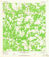
1963 Map of Ander
USGS Topo · Published 1965About this map
Cattle ranching and petroleum extraction define the landscape of south Texas in this early 1960s survey, where the borders of Victoria, Goliad, and De Witt counties converge. Small agricultural settlements like Ander and Weser anchor a terrain crisscrossed by fences and pipelines, reflecting the industrial expansion of the Mission Valley West Gas Field and the Meyersville Gas Field. The map records several family and community burial grounds, including San Jose Cem and the Danforth Cem, which serve as vital markers for local genealogical research. An intricate network of drainages such as Eighteenmile Creek and Fifteenmile Creek wind through the acreage, punctuated by numerous gravel pits that speak to the region's resource-based economy during this era of post-war development.
Find a feature on this map
26 named features on this map. Tap any name to fly to it.
Don’t see what you’re looking for? This feature index may not catch every label — zoom into the map to look around manually.
Map Details
Editions of this 1963 Ander Map
2 editions found
Other maps of this area

1953 · Beeville
USGS Topo · 1:250,000

1956 · Beeville
USGS Topo · 1:250,000

1960 · Beeville
USGS Topo · 1:250,000

1962 · Fannin
USGS Topo · 1:24,000

1962 · Hensley Lake
USGS Topo · 1:24,000

1962 · Goliad
USGS Topo · 1:24,000

1963 · Meyersville
USGS Topo · 1:24,000

1963 · Weesatche
USGS Topo · 1:24,000
1963 · Yorktown East
USGS Topo · 1:24,000
1963 · Mission Valley
USGS Topo · 1:24,000