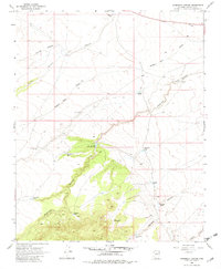
1968 Map of Anderson Canyon
USGS Topo · Published 1982About this map
Anderson Canyon and its many offshoot drainages define this high desert plateau in Coconino County, where water management was essential to ranching operations in the late 1960s. The landscape is marked by a network of catchments and wells, many bearing the names of local figures or families, such as Lute Hart Tank, Boyd Reid Tank, and Casner Tank. The terrain is deeply incised by erosion, with Wagon Box Draw, Yellow Jacket Canyon, and Wallace Canyon providing natural corridors through the mesa country.
Find a feature on this map
21 named features on this map. Tap any name to fly to it.
Don’t see what you’re looking for? This feature index may not catch every label — zoom into the map to look around manually.
Map Details
Editions of this 1968 Anderson Canyon Map
4 editions found
Other maps of this area

1886 · San Francisco Mtns
USGS Topo · 1:250,000

1887 · Verde
USGS Topo · 1:250,000

1891 · San Francisco Mtns
USGS Topo · 1:250,000

1892 · Verde
USGS Topo · 1:250,000

1894 · San Francisco Mtns
USGS Topo · 1:250,000

1899 · San Francisco Mtns
USGS Topo · 1:250,000

1947 · Flagstaff
USGS Topo · 1:250,000

1954 · Flagstaff
USGS Topo · 1:250,000

1954 · Holbrook
USGS Topo · 1:250,000

1957 · Holbrook
USGS Topo · 1:250,000