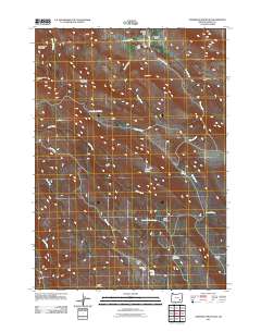
2011 Map of Anderson Mountain
USGS Topo · Published 2011About this map
Anderson Valley and its surrounding high-desert terrain dominate this portion of Harney County, where sparse settlement and ranching operations define the landscape. Water sources are the primary drivers of human presence here, evidenced by landmarks like Louie Hughes Spring, Cold Spring, and the Upper Paul Creek Spring. The map documents established holdings such as the Anderson Valley Ranch and the Bill Griffin Ranch, alongside the geographically isolated Tommies Homestead to the south. Significant elevations including Anderson Mountain and Little Riddle Mountain overlook a complex network of seasonal drainages, including Buster Creek and Camp Creek. For those studying the history of land use in the Oregon outback, the survey provides a detailed view of livestock-related features like Buck Pasture and the flat, open expanses of McBain Flat and Orejana Flat.
Find a feature on this map
27 named features on this map. Tap any name to fly to it.
Don’t see what you’re looking for? This feature index may not catch every label — zoom into the map to look around manually.
Map Details
Editions of this 2011 Anderson Mountain Map
This is the sole edition of this map. No revisions or reprints were ever made.
Other maps of this area

1955 · Burns
USGS Topo · 1:250,000

1955 · Adel
USGS Topo · 1:250,000

1957 · Adel
USGS Topo · 1:250,000

1958 · Burns
USGS Topo · 1:250,000

1958 · Adel
USGS Topo · 1:250,000

1959 · Burns
USGS Topo · 1:250,000

1962 · Adel
USGS Topo · 1:250,000

1967 · Happy Valley
USGS Topo · 1:24,000

1967 · Adobe Flat
USGS Topo · 1:24,000

1968 · Poison Springs
USGS Topo · 1:24,000