
1968 Map of Poison Springs
USGS Topo · Published 1971About this map
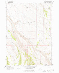
Poison Springs and the surrounding high-country drainages of Harney County are documented here during a 1968 field survey. The landscape is defined by its seasonal water sources and steep canyons, with the drainage of Kiger Creek and Little Kiger Creek cutting prominently through the western portion of the sheet. To the north, The Lambing Ground suggests the seasonal livestock movements once common in this part of Oregon, supported by water features like Wood Camp Reservoir and Shepherd Spring. A network of unnamed jeep trails provides the only infrastructure across these elevations, connecting remote points such as Waterhole Spring in the south to Swamp Creek in the north. This map captures the functional geography of the range before modern development, showing the specific locations of numerous high-elevation Springs and named creeks like Smyth Creek and Mahan Creek that sustained early ranching and transit through the territory.
Find a feature on this map
18 named features on this map. Tap any name to fly to it.
Don’t see what you’re looking for? This feature index may not catch every label — zoom into the map to look around manually.
Map Details
Editions of this 1968 Poison Springs Map
2 editions found
Other maps of this area

1955 · Burns
USGS Topo · 1:250,000

1955 · Adel
USGS Topo · 1:250,000

1957 · Adel
USGS Topo · 1:250,000

1958 · Burns
USGS Topo · 1:250,000

1958 · Adel
USGS Topo · 1:250,000

1959 · Burns
USGS Topo · 1:250,000

1962 · Adel
USGS Topo · 1:250,000

1967 · Happy Valley
USGS Topo · 1:24,000

1967 · Diamond
USGS Topo · 1:24,000
1968 · Krumbo Ridge
USGS Topo · 1:24,000