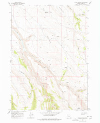
1968 Map of Poison Springs
USGS Topo · Published 1978About this map
Poison Springs Creek and numerous high-desert water sources define this remote stretch of Harney County, recorded just before the late 1960s. The landscape is marked by the seasonal and perennial drainages that support livestock and wildlife, most notably at The Lambing Ground in the north. This area shows the critical importance of water management in the Oregon high desert, featuring the Wood Camp Reservoir and a network of named springs such as Shepherd Spring and Waterhole Spring.
Find a feature on this map
23 named features on this map. Tap any name to fly to it.
Don’t see what you’re looking for? This feature index may not catch every label — zoom into the map to look around manually.
Map Details
Editions of this 1968 Poison Springs Map
2 editions found
Other maps of this area

1955 · Burns
USGS Topo · 1:250,000

1955 · Adel
USGS Topo · 1:250,000

1957 · Adel
USGS Topo · 1:250,000

1958 · Burns
USGS Topo · 1:250,000

1958 · Adel
USGS Topo · 1:250,000

1959 · Burns
USGS Topo · 1:250,000

1962 · Adel
USGS Topo · 1:250,000

1967 · Happy Valley
USGS Topo · 1:24,000

1967 · Diamond
USGS Topo · 1:24,000

1968 · Poison Springs
USGS Topo · 1:24,000