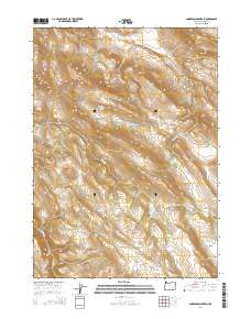
2014 Map of Anderson Mountain
USGS Topo · Published 2014About this map
Anderson Mountain and its surrounding high-desert terrain dominate this 2014 survey of Harney County. The landscape is defined by its seasonal hydrology and named grazing lands, including the expansive McBain Flat and Orejana Flat. Water sources were critical for the ranching operations that shaped this region, evidenced by named points like Louie Hughes Spring, Cold Spring, and the McBain Flat Spring. The map documents the drainage patterns of Buster Cr and Paul Cr as they cut through the volcanic topography between Riddle Mountain and Little Riddle Mountain. This area represents a classic example of the Great Basin's land use, where named areas like Buck Pasture reflect a long history of open-range cattle management. The only significant transit corridor shown is the rugged Anderson Valley Rd, which provides access to the isolated Anderson Valley and its surrounding peaks.
Find a feature on this map
23 named features on this map. Tap any name to fly to it.
Don’t see what you’re looking for? This feature index may not catch every label — zoom into the map to look around manually.
Map Details
Editions of this 2014 Anderson Mountain Map
This is the sole edition of this map. No revisions or reprints were ever made.
Other maps of this area

1955 · Burns
USGS Topo · 1:250,000

1955 · Adel
USGS Topo · 1:250,000

1957 · Adel
USGS Topo · 1:250,000

1958 · Burns
USGS Topo · 1:250,000

1958 · Adel
USGS Topo · 1:250,000

1959 · Burns
USGS Topo · 1:250,000

1962 · Adel
USGS Topo · 1:250,000

1967 · Happy Valley
USGS Topo · 1:24,000

1967 · Adobe Flat
USGS Topo · 1:24,000

1968 · Poison Springs
USGS Topo · 1:24,000